
Saturday, December 31, 2011
Tarawa - New Years Day 2012
It is New Year's Eve and as a follow up to the Christmas day map of Christmas Island I have done another map for 1:1200 scale wargaming:
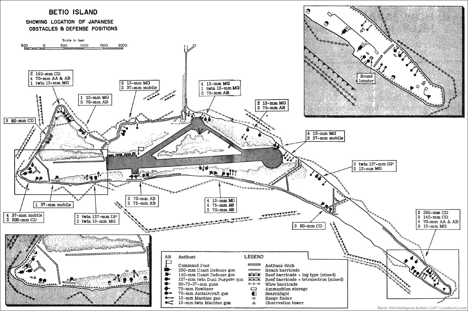
 This is Betio. One of the two dozen or so islets that constitute the Atoll known as Tarawa. This version is somewhat based on a map of Tarawa as it was in 1943 when the USMC took it from the Imperial Japanese Army. The airfield, dock, and compass arrow are as faithful to the source map as possible. The various symbols around the edges of the island represent different 1:1200 scale buildings available from Spartan Games. The grid squares are 12x12 inches (or 1200 scale feet square). The sea squares are filled with two different shades of blue to show that two 4x6 foot tables are needed to model the entire island at a scale of 1:1200.